Community-based flood monitoring Gia Lai province, Vietnam
Solutions Brief
The ‘Solutions’ series shares practical and replicable local knowledge through our work across Vietnam on how to build resilience to climate hazards.
Summary
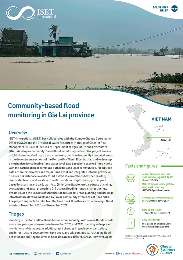
ISET-International (ISET) has collaborated with the Climate Change Coordination Office (CCCO) and the Division of Water Resources in charge of Disaster Risk Management (DRM) of the Gia Lai Department of Agriculture and Environment (DAE) develop a community-based flood monitoring system. The project aims to establish a network of flood trace monitoring points in frequently inundated areas in the downstream sections of the Kon and Ha Thanh River basins, and to develop a mechanism for collecting flood water level data based on observed flood marks with the participation of commune authorities and local communities. Flood trace data are collected after each major flood event and integrated into the provincial disaster risk database in order to: (i) establish correlations between rainfall, river water levels, and location-specific inundation depths to support impactbased forecasting and early warning; (ii) inform disaster preparedness planning, evacuation, and asset protection; (iii) assess flooding trends, changes in flow dynamics, and the impacts of urbanization to support urban planning and drainage infrastructure development; and (iv) raise community awareness of flood risks. The project supported a pilot to collect and mark flood traces from the major flood events of November 2020 and November 2021.
Funded by: The Z Zurich Foundation
The Zurich Climate Resilience Alliance is a multi-sectoral partnership focused on enhancing resilience to climate hazards in both rural and urban communities.